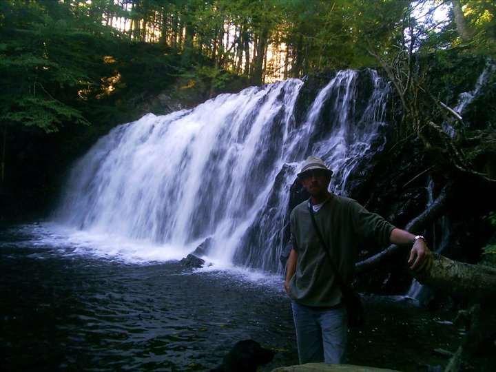
HAMMONDS BROOK FALLS
Glengarry, Inverness County
46° N 02.281 061° W 27.400
UTM: 20T E 619421 N 5099430
RIVER: Hammonds Brook (seasonal)
WATERSHED: Southwest Mabou River
CLASS: steep cascades
SIZE: 8', 6', 8', 20'
RATING: below average (**) seasonal flow
TRAIL: improved trail, bushwhacking
DISTANCE: 4.15km
HIKING TIME: 1hr
CONDITIONS: moderate
GEOCACHE: GC2EX6J
NS Atlas Page: 12/V5
NS topo map: 011K03 (Lake Ainslie)
DRIVING DIRECTIONS: From the Canso Causeway, take the exit for HWY19 off the roundabout. Follow this highway north for 56.1km, approaching the village of Mabou. Turn left onto Little Mabou Rd. and pull into the parking area for the Celtic Shores Trail (part of the Trans Canada Trail) 40m on your right.
TRAIL DESCRIPTION: cross the road and hike along the Celtic Shores Coastal Trail for approximately 4km, to a small bridge over Hammonds Brook, a seasonal stream. (My visit, in mid-May, the brook was already quite dry, but I will return after a good rainstorm to get better photographs)
Head upstream about 350m to the main falls. There are smaller falls along the way upstream, but the highest falls, pictured below, are the furthest upstream and are much more geologically diverse than the lower falls, which tend to be still actively eroding sites of friable and greatly fractured slate. The upper falls drop over a flat slab of stone approximately 8feet high before becoming a steep cascade over the fractured slates found further downstream for the rest of its course.
Named for the original grant holder, John Hammond, one of Cape Breton's Loyalist pioneers. Mr. Hammond arrived in the area in 1793, having found his original grant at Manchester, Guysborough County to be poor land for farming.
He served with the 40th British Regiment during the latter days of the American Revolution and originally immigrated from the Parish of Currin, County Monaghan, Ireland. He remained listed as a 'Servicable' milita member under Captain Hugh Watts' Company in the 2nd Regiment of the Cape Breton Militia in 1813.
This hike will take you long the shores of the Southwest Mabou River, which rises in the Creignish Hills to the east of Judique. A popular eagle nesting area, keep your eyes out for these and other predatory birds along your hike, as well as the seasonal flocks of Canada geese that nest near Nicholson Island, at the mouth of the river.


I like this content very much.
ReplyDeletecheck out also this article on beautiful waterfall in the world:
Most beautiful waterfall in the world