
Three Mile Plains, Hants County
44N57.328 64W05.510
20T E413880 N4978583

RIVER: Maple Brook
CLASS: stepped
SIZE: 6'
RATING: average (**1/2)
TRAIL: dirt road/bushwhacking
DISTANCE: 1.2km
HIKING TIME: 45 minutes
CONDITIONS: moderate
GEOCACHE: none
NS Atlas Page: 57/Z1
NS topo map: 021A16 (Windsor)

DRIVING DIRECTIONS: from Windsor, take EXIT5 off HWY101 west towards Three Mile Plains. Proceed along HWY14 approximately 1km and turn left at the Irving gas station to remain on HWY1. Continue 1.7km to the Three Mile Plains Elementary. Park here.
TRAIL DESCRIPTION: turn back up HWY1 approximately 100m to the former Windsor/Hantsport railbed. Cross the road at the tracks and turn left onto them. Follow the tracks approximately 600m to a bridge over Maple Brook. Walk just past the bridge and cross over to the field on your left. Turn to the right and hike down on the old grass covered road to its conclusion about 500m along. Turn left on the dirt road and keep to the left at the fork in the road about 100m on. Follow this road below the quarry another 150m and follow the stream into the ravine. Hike upstream 400m to the falls.
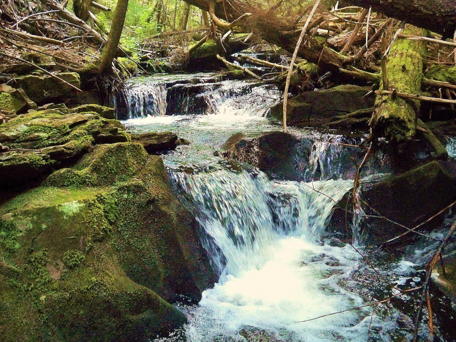
These small falls drop over six steps of varynig height over a 5m run of the brook. Nestled in a quiet, undisturbed ravine, surrounded by moss draped deadfall and exposed bedrock, these small falls are quite picturesque. Ive given them the name Breicher Falls for the original grantee of the lands they are on, as Maple Brook has another set of falls, a ten foot plunge, much further upstream.


No comments:
Post a Comment