
Kentville, Kings County
45N02.892 64W30.450
20T E381313 N4989641

CLASS: steep cascade
SIZE: 10', 50'
RATING: excellent (****)
TRAIL: path, through tunnel
DISTANCE: 500m
HIKING TIME: 30 minutes
CONDITIONS: moderate
Geocache: GC1A9HD/GCN8PD
NS Atlas Page: 46/Z5
NS topo map: 021H02

picture falach fead (2008)
DIRECTIONS: from Kentville, take Exit1 3 from HWY1 01 , north onto HWY1 2 towards town.
Take your first right, onto Prospect Rd. Drive up this road approximately 1 .2 km, parking just
before Morris Crescent.
Upper Moores Brook Falls

photos Sylvia Fisher
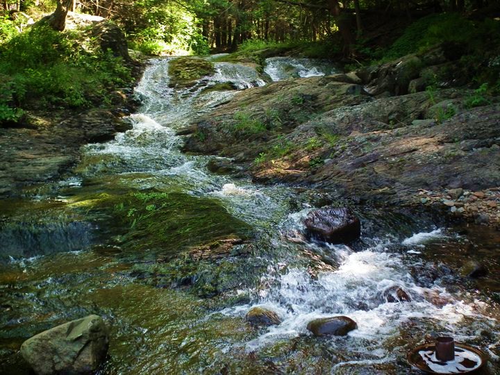
Trail Description: walk upstream to main falls. There are paths alongside the stream, as this is a popular spot for short hikes around Kentville. You will first encounter a smaller set of falls, approximately 10 feet in height. When you round the sharp bend in the stream just beyond this, you will find Moores Falls, a very impressive 50 foot waterfall. If you continue downstream, climbing up the left-hand side of the falls, the water chutes thru a tight frothy bend carved into the bedrock. Continue through the tunnel underneath the 101 highway, there are slight ledges along both sides of the tunnel if you have good balance, otherwise walk up thru the smooth, but sometimes slippery, water. On the other side of the tunnel, there is a third set of falls along this brook, pictured above, that are worth the visit.

chute above main falls

first falls along Moores Brook, just before main falls

the same as above, in winter
photo Benoit Lalonde


No comments:
Post a Comment