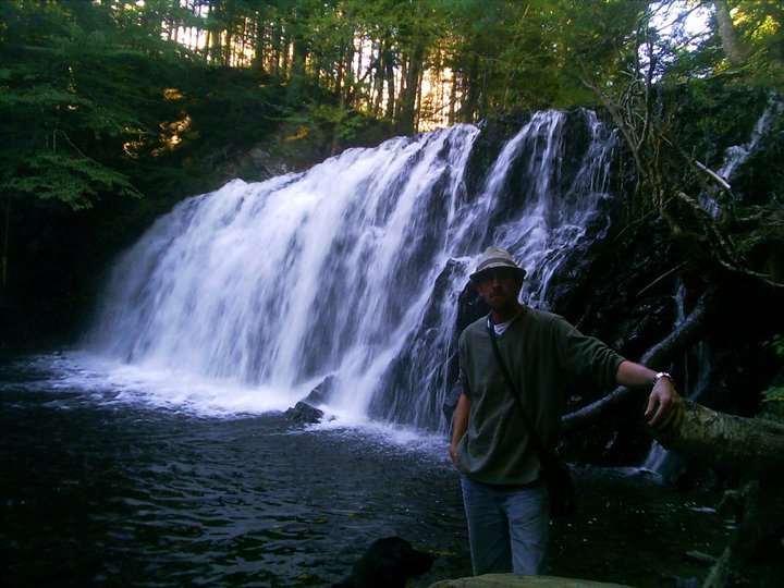
GRAYS HOLLOW FALLS
Cape North, Victoria County
N 46° 53.382 W 060° 33.257
20T E 686315 N 519581 0
photo Robert Pierrynowski (2008)
RIVER: Southwest Branch Brook (of Grays Hollow Brook)
CLASS: plunge/steep cascade
SIZE: 125'
RATING: excellent (****)
TRAIL: woods trail/upstream
DISTANCE: 5km
HIKING TIME: 4 hours
CONDITIONS: challenging
Geocache: GC148DV
NS Atlas Page: 3/Z3
NS topo map: 011K15 (Pleasant Bay)
photo geoscotians (2009)
DIRECTIONS: from Ingonish, follow the Cabot Trail northbound to Cape North. Turn right onto
Bay St. Lawrence Road, then left after 2km onto North Side Road. Follow this road to a white
farmhouse at 46N53.202 060W31 .752, and park off the side of the road.
Trail Description: after asking permission from the house owners, cross the field and make your
way to Grays Hollow Brook. Walk upstream, until Southwest Branch Grays Hollow Brook meets
the main watercourse at 46N53.457 060W32.91 5. Walk up this stream, staying to the south
bank of the stream, crossing over to the north side of the stream
just before the base of these falls.
Gray`s Hollow Brook has no less than eleven waterfalls of note,
which would make for great separate hikes if you are in the area
for a few days, and there is nothing quite like trekking deep into
the woods, passing vistas very few before you will have seen.
Whiskey Den Falls and McAvoys Falls lie far upstream along the
main Gray's Hollow Brook, along tributary streams. Whiskey Den
Falls are listed at seventy feet in height and McAvoys falls are
listed on the Fletcher/Faribault series of geological survey maps
as being 60 feet tall.


No comments:
Post a Comment