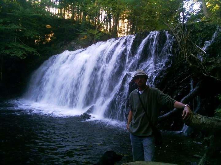
BEAUVAIS LAKE FALLS
Grand Greve, Richmond County
N 45° 38.307 W 060° 50.676
20T E 667980 N 50561 38

photo Charles Doucette (2011)
CLASS: plunge/cascade
SIZE: 12'
RATING: average (**1 /2)
TRAIL: upstream
DISTANCE: 400m
HIKING TIME: 45 minutes
CONDITIONS: moderate
GEOCACHE: GC4CN3R
NS Atlas Page: 34/W3
NS topo map: 011F10 (St. Peter's)
DRIVING DIRECTIONS: from St. Peter's, follow HWY4 eastward out of the village, turning right onto HWY247 towards L'Ardoise. Continue on this road approximately 3km, watching for an old
quarry pull-off on your left hand side. (45N38.089 60W50.787) Pull into this road, and park to the side.
Trail Description: cross under the roped gate and directly up into the woods on your left hand side. These woods will lead you to the clearing above the gravel pit, at which point head essentially to your right, picking your way along game trails. There is a lot of deadfall hidden in those young pine trees, which can make going very sloggy. Try to aim for the brook as soon as you can, hiking directly upstream can be easier, although the lower portions of this brook are very choked.
(photo: Benoit Lalonde)
The lowest set of falls are perhaps 6 feet in height, and are a little under 100m downstream of the main set of falls. The main falls here feature two steep (85degree pitch) falls, each between 12-15 feet in height. A level stretch of stream, perhaps 20 feet in length, separates the two falls. Scaling up the lower of these two falls is easiest on the left hand side, and while extraction from the ravine to the right from the upper falls is easy, the woods along the ridge here are twisty and full of criss crossed deadfall hidden from ankle to chest height.
(photo: Benoit Lalonde)
Beauvais Lake Shared-Use Trail, has become quite overgrown and is difficult to find, but the hike up to the lake is rewarding in the unspoilt vistas it presents.


No comments:
Post a Comment