
Moose Brook, Hants County
45 N 17.205 63 W 48.242
20T E0436947 N5015124

RIVER: Bear Brook
CLASS: cascade (steep)
SIZE: 20', 15'
RATING: excellent (***)
TRAIL: bushwhacking
DISTANCE: 200m
HIKING TIME: 15 minutes
CONDITIONS: difficult
Geocache: none
NS Atlas Page: 38/X5
NS topo map: 11E05 (Bass River)

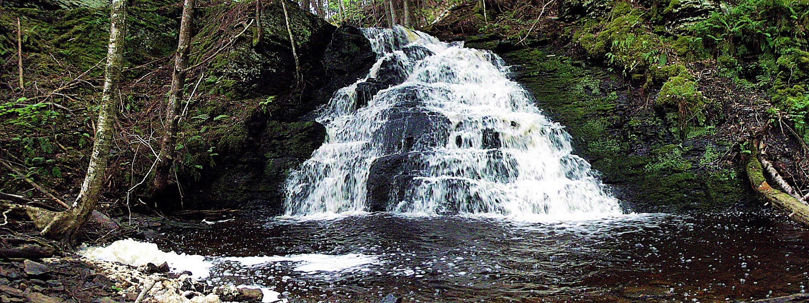
photo by benoit lalonde (2011)
Driving Directions: from Stewiacke, drive south down HWY102 5.9km to Exit 10, turning left onto HWY215. Drive 53km, past the village of Noel. At the bridge over Bear Brook, which is about 300m past Burntcoat Road on your left. (4km from Noel). There are no great parking areas on this stretch f highway, I was lucky enough to encounter the houseowner of the property adjacent the brook, and was given permission to park there and take their small path down to the brook.

Trail Description: There is no real trail to the falls, I ventured downstream thru the brook which was running quite low, but you can generally skip across the stream from side to side. There are a few large deadfalls across the stream, but once you reach the upper falls approximately 100 along the brook, the remaining 150m to the larger, lower falls is relatively easy hiking.

These falls were quite dry the day i visited, but one could see the potential for a lovely spot (see Benoit Lalonde's photo above to illustrate the contrast). The upper falls drop over an overhanging outcropping and take a sharp 90 degree turn to the left, continuing along the stream to the lower falls. These fan out over a steep stepped fall into a pool below.

**UPDATE**
The home owners on the western side of the brook have expressed concern over waterfall enthusiasts visiting this site disturbing their animals. Access is still possible by speaking with the householder of the property on the eastern side of the brook, who will direct you to a trail thru the clear cut behind her garage, which has a faint trail to follow to the brook near the top falls. Continue along the easttern side of the brook to the lower, larger falls.


the upper falls, on a dry run

No comments:
Post a Comment